It’s hard to see the big picture when it comes to Singapore‘s amazing and speedy development over the years when you’re just walking around its various neighbourhoods. For a small country with 6 decades of independence to our name, Singapore’s transformation is really quite remarkable, especially when you find out that all these developments are part of larger master plans that have been years in the making.
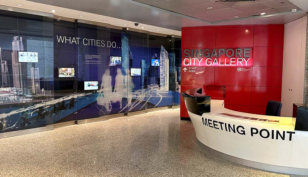
Located in Chinatown across the road from the popular Maxwell Food Centre is the Urban Redevelopment Authority (URA) Centre, home to a free public gallery called the Singapore City Gallery which showcases this transformation with easy-to-understand and visual exhibits.
I enjoy bringing visitors to Singapore to check out this gallery because it really is a rare chance to get a bird’s eye view of Singapore with the cool scale models and understand how it became what we know today. Also, fun fact – this is the spot I took my tourist guide license exam in! Here are my tips on what you should check out when you visit the Singapore City Gallery.

Singapore City Gallery – in a nutshell
What is this: The Singapore City Gallery documents the urban development of Singapore from its early fledgling days to the modern metropolis of today over 3-storeys.
Why it’s worth visiting:
- The scale models on level 1 and level 2 show you a rare birds-eye view of Singapore to better understand how the country looks like at a glance and what future developments might take place
- The regular video-projection show that utilises the level 1 scale model gives a quick summary of Singapore’s development history and also showcases different parts of Singapore which is fun and insightful for all ages
- Lots of insight into past projects as well as upcoming works show the evolution of thinking in country building
Who should visit: Tourists interested in the social and economic aspects of how Singapore came to be what it is today in such a short amount of time. Locals who want to better understand the government’s consideration in developing various neighbourhoods
Where is this located: URA Centre Level 2 – 45 Maxwell Road, Singapore 069115. [Google maps] Nearest MRT: Maxwell (TE18) or Chinatown (DT19/NE4). Located in Chinatown.
When to visit: Singapore City Gallery is open 10am-5pm, Mon-Sat (closed on Sundays). Guided tours are available on Tuesdays, Thursdays and 2nd/4th Saturdays in the month.
How to visit: Check out the Singapore City Gallery for more information.
About Singapore City Gallery
The Singapore City Gallery showcases the urban development of Singapore from its early fledgling days to the modern metropolis of today.

The Singapore City Gallery is very conveniently located in the Central Business District, not far from the Singapore River and in Chinatown, opposite the popular Maxwell Food Centre. I often pop by when doing Chinatown tours because it’s a great way to showcase other districts around Singapore that tourists don’t often get to see and illustrate how Singapore has developed in a more visual manner.
Singapore City Gallery: What to expect
The public exhibits in the Singapore City Gallery cover three floors.

Level 1: Singapore Scale Model
You enter from Kadayanallur Street, and the first thing you see is the large islandwide model in white to the right which showcases the entire map of Singapore with all the buildings.
I like this model because it demonstrates a couple of interesting things. You can see how the city sprawled out from its hub in the south along the river and the many, many tall buildings we have all around. You’ll also notice that Singapore has a surprising amount of greenery towards its central and northern areas, and a hint of some of our nearer offshore islands like Pulau Ubin and Sentosa.

Every 20 minutes (xpm, x.20pm, x.40pm) there is a regular audio-video show about the past and future developments of Singapore which is played on the nearby screen, and places mentioned in the video are correspondingly lit up on the scale model. The model is also used as a mini projection screen while the show is being played. It’s a pretty cool introduction into the work of the Urban Redevelopment Authority even if it does sometimes feel a bit like propaganda.

Sometimes you get temporary exhibitions around the Islandwide model or in the main atrium area. Usually these are related to upcoming neighbourhood plans for future developments – some that I saw recently showed how they are planning to turn Singapore’s former horse racing Turf Club area into a residential neighbourhood while keeping some of its heritage elements, as well as that of the upcoming Long Island project which involves a lot of reclamation off East Coast Beach.
Level 2: Entrance to Gallery + Central Area Scale Model
Those interested to see more should head upstairs to the 2nd floor where the official entrance to the Singapore City Gallery is located. Turn to the right to follow the recommended path.
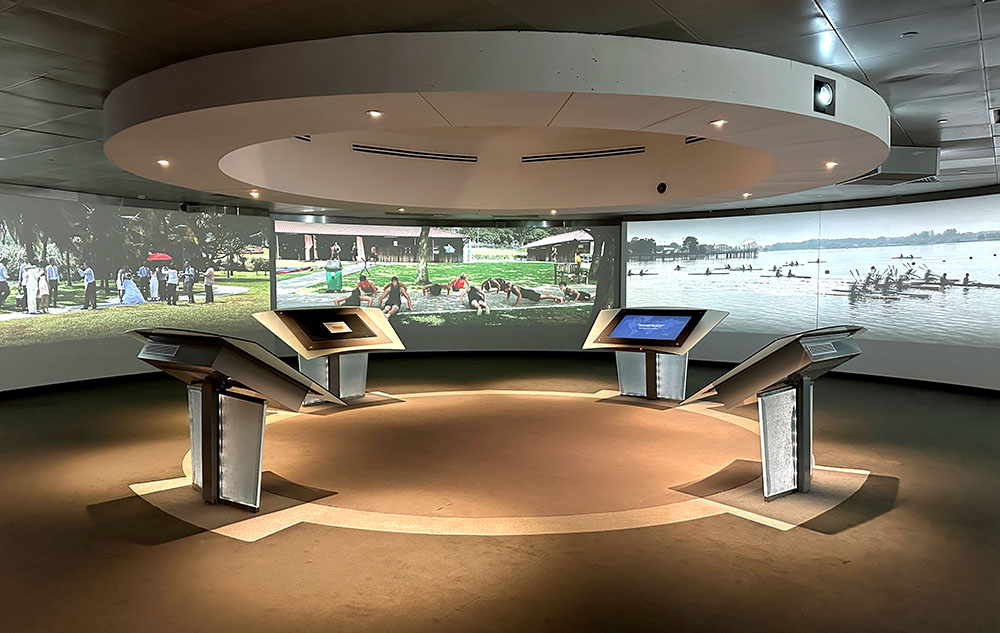
The first room after the entrance is a round gallery playing videos all around, a look at the daily lives of Singaporeans recorded over 24 hours. There are some touch screen panels as well as scenes of the night skyline.
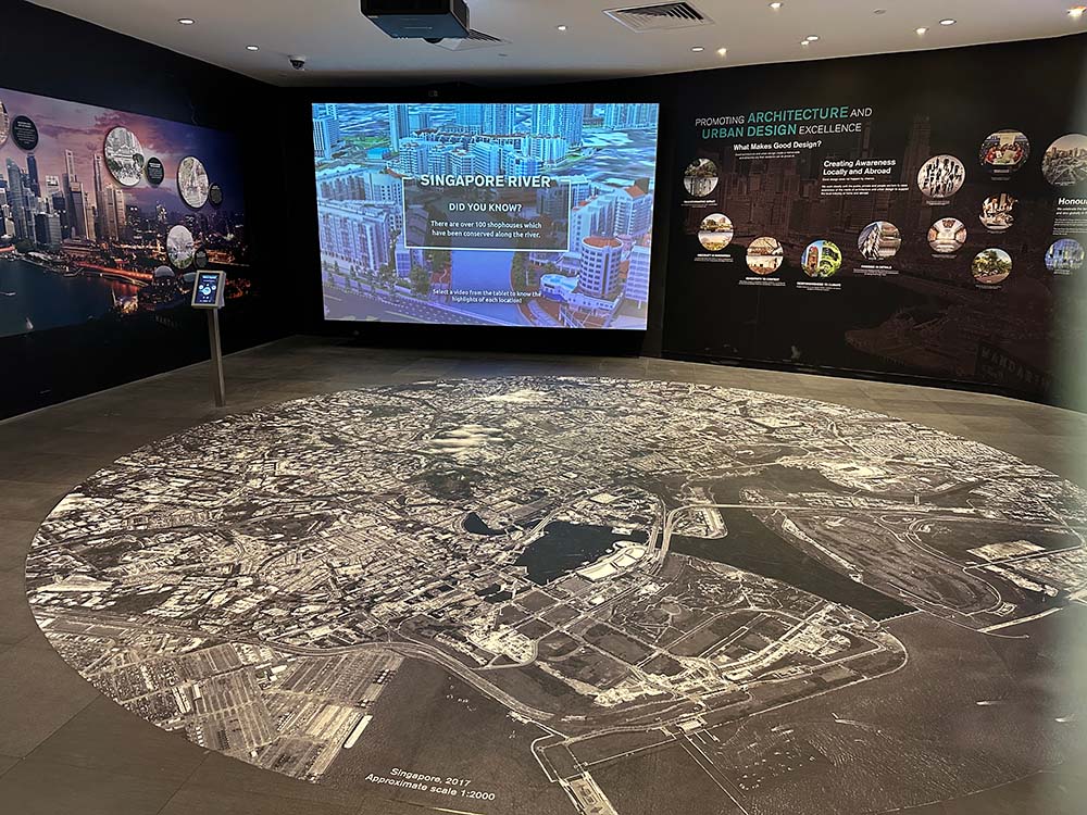
However if you’re short on time or just not into so much detail, you can turn left where the exit of the exhibition is to go directly to the Central Area scale model which covers the Singapore River, Chinatown, Orchard Road, Kampong Gelam, Little India and Marina Bay. The scale here is much larger so you can see a lot of building detail, even the actual location of this gallery as seen on the map.
Interestingly this scale model also shows a lot of future plans. All the tall buildings in the Marina Bay area for example are blank and just a representation of possible future developments in the area. You get a better sense of Singapore’s architecture and skyline from this model compared to the one on the first floor.
This model also looks pretty cool if you go up to the 3rd floor and look down at it from above!


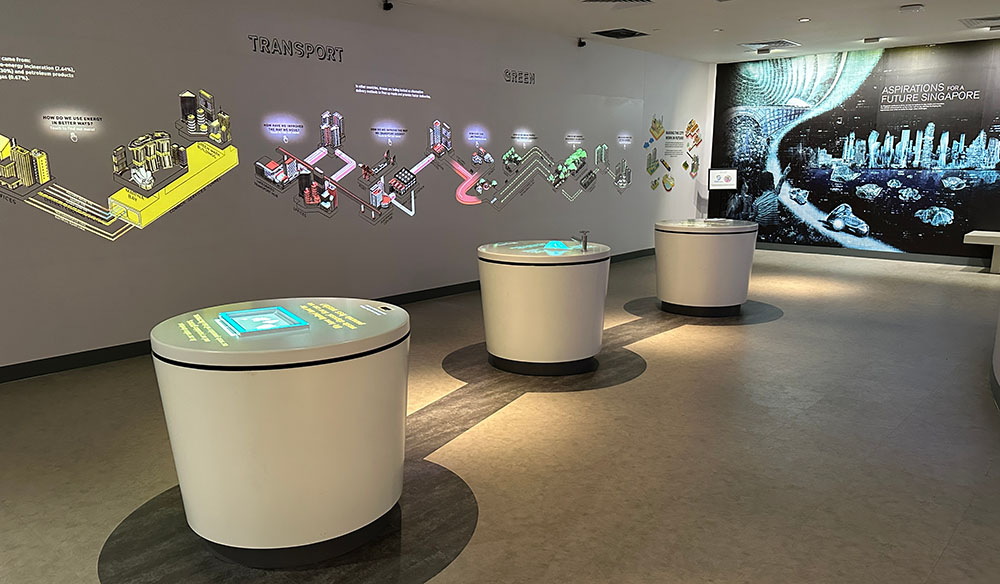
Level 3: Land use maps, other developments
As you climb up the stairs from the 2nd floor, you’ll pass through a corridor that illustrates the development of Singapore through the years. Though it briefly touches on the pre-British days, most of it is focused on Singapore’s development around and after independence (1960s onwards).

At the end of the timeline is a video touch-screen wall which has a pretty cool map talking about land use in Singapore and illustrating the many different types of land parcels. Cartography geeks will enjoy this a lot, while locals might enjoy getting a more detailed understanding of the way land has been zoned in Singapore or their own neighbourhoods.

The rest of the exhibits up here are a mix of topics like land reclamation, underground expansion or transport network to explain how Singapore has developed the way it has, while others cover the heritage aspects like shophouse architecture and neighbourhood development. Most of it is quite visual and involves interactive elements – maybe a lot for the general tourist, but it’s easy enough to skim through these galleries.
Getting to Singapore City Gallery
Singapore City Gallery is located in the URA Centre in Chinatown. Located right next to Maxwell Food Centre, the closest MRT station is Maxwell (TE18) on the brown Thomson East Coast Line, though Chinatown (DT19/NE4) on the blue Downtown and purple Northeast Line and Tanjong Pagar (EW15) on the green East-West Line are also pretty nearby.
What’s nearby
Recommendations for tourists
I usually like to have Singapore City Gallery as a stopover point when doing any Chinatown tour. After talking about the history of Chinatown and how it came to be, being able to show this with the scale model is always useful for better understanding.
Joining one of the guided tours in the gallery might be a good way to understand the exhibits better. They have volunteers who give guided tours on Tuesdays, Thursdays and 2nd/4th Saturdays in the month.
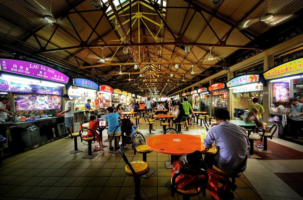
I recommend visiting this gallery in the afternoon after lunch. Since the gallery is right opposite the famous Maxwell Food Centre so you can always pop by after while letting your Hainanese Chicken Rice meal digest. But also because this gallery is air-conditioned, it’s better to spend a cooler morning exploring the streets of Chinatown, and then hiding in here from the midday sun.
Chinatown has several sub-areas you can see more of – I have a Chinatown street art guide if you want to check out murals. The URA building is located in the Telok Ayer area so you can see more religious buildings at Telok Ayer Street. Head across South Bridge Road to see Kreta Ayer or the ‘downtown Chinatown’ area, and go towards Tanjong Pagar if you
Other free galleries nearby
If you are looking for other free museums and galleries in the area, pop by the Buddha Tooth Relic Temple on the other side of Maxwell Food Centre. This is a working Buddhist temple on the 1st floor, but they have a museum of Buddhist sculptures and art on the 2nd and 3rd floors and the so-called tooth relic on the 4th floor.

The Singapore Chinese Cultural Centre (SCCC) where you can learn more about the Singapore Chinese identity is about 10-15 mins walk away. Read my detailed review of the SINGAPO人 exhibit at SCCC for more.
Check out my ever-growing guide to free museums and galleries to visit in Singapore or see more posts about things to do in Singapore.
